June 25, 2011

Gen Y


"Previous generations found freedom and flexibility through the car.  But Generation Ys find their freedom and flexibility by staying connected to their friends, family and workplaces through the various information devices - like their laptops, or iphones.

"They can stay connected on a bus or a train. They can bring the office with them. They can bring their study with them. They can bring their friends with them. They can't if they're driving."

-- Peter Newman, Curtin University, Perth, Australia, quoted in the West Australian

June 1, 2011

Bike Accident Tracker: Contra Costa Least Safe Place to Bike

Hola amigos, I know it's been a while since I rapped at ya, but I've been trying to figure out what my intentions and ambitions with this publication are, exactly.

In the meantime, a totally excellent example of public data sharing and professionally-managed crowd-sourced journalism: The Bay Citizen's Bike Accident Tracker. Maps, charts, data. Agent at fault, type of crash. Really great stuff.

Click to enlarge--and note the customized search/sort featers at left.

Aggregated results: Contra Costa County is the worst. Not for the total number of crashes, but for the percentages of bike commuters who are involved in accidents. From 2005 to 2009 there was an average of 288 accidents involving cars and bicycles in CC, or 11% of the roughly 2568 bike commuters.

San Francisco, though it posted far more accidents, also posted far more commuters--and only 4% of them were involved in crashes.

April 15, 2011

Emeryville, Food Trucks, and Redevelopment

Had my first trip to Emeryville in several years today to visit my friends' new food truck: Doc's of the Bay and found several observations worth noting. The most important of which is that Doc's makes excellent food, and just got a new paint job.

1) The boundary between Emeryville and Oakland is crystal clear. Adeline St is the proverbial line in the sand as one walks east/west along 40th St. On the eastern, Oakland side, the streetscape was mostly residential, with one respectable-looking housing project amid single dwelling homes in various stages of vibrancy and disrepair. It felt low-key--cracked sidewalks, green mossy bits around the edges, a bit of that gritty Oakland feel. As I waited to cross Adeline I thought, huh, look at that big new apartment building! And my, it looks like they are restoring that home over there! What's that banner say? "Paid for by the Emeryville Redevelopment District" ... bing.

Which one's which?

 I don't know a whole lot about Emeryville, but I know enough to know that it has a relatively small population base, and a very high tax base: Ikea has a store there, but more importantly Novartis and Pixar have large, multi-block campuses. Pixar's is expanding--looked like contruction was almost finished. Given what I know about Redevelopment Districts, my guess at the history of Emeryville is that some enterprising city officials found a way to declare the highway and railyard and warehouse-heavy town as blighted, established a Redevelopment Zone, passed some tax breaks for office developments, and are just feasting off of the additional tax revenue. For example: a free shuttle runs every 15 minutes M-F from Macarthur BART east along 40th and then north into Emeryville for a rather extensive loop. Walnut Creek has a similar service, but that one runs maybe 1/8th the distance with the same frequency, with corresponding savings in drivers and buses.

All this historical-politico speculation is just deductive guessing, maybe I should do some research, huh?

2) Pixar has a like two-story tall statue of its trademark hopping lamp logo.

Thanks, interwebs!
3) As the EmeryGoRound (AKA Free shuttle ... cute) turned left onto 40th from Watts, one of the brick buildings on the left hand side had a garage door open enough to reveal a room full of beautiful foreign cars. Lambos, Ferraris, MB, etc. Google maps tells me there's a MB dealer there, but for sure there were swoopier cars than that. It was eye-popping.

March 24, 2011

New SF Affordable Housing

SJ Mercury News: The Metropolitan Transportation Committee has committed $10 million to a $50 million revolving fund for affordable housing near transit stops. Morgan Stanley, Citi Community Capital, and several other financial and nonprofit groups to create the fund, called the Bay Area Transit Oriented Affordable Housing Fund.
Officials plan to make the first $4.8 million loan to buy a San Francisco parking lot where developers plan to construct a 14-story building with 150 apartments and a ground-floor grocery story at Eddy and Taylor streets.
It's great to see money being freed up for housing, post economic liquidity/loan contraction. Affordable housing is also chronically underfunded, as, you know, incentives skew more strongly toward non-affordable housing (read: luxury condos). Such is life, such is the market.


Map:


Street view:

Of course, the shortage of parking in SF is a bone of contention. But in the heart of downtown, I can think of better lot uses than car storage.

March 18, 2011

San Antonio Water Conservation

From the NYTimes: San Antonio is buying conservation easements from area land owners in order to preserve the long term viability of the Edwards Aquifer, the city's primary water source.

I'm not a legal expert, but my understanding is that land easements are legal obligations written into the land's deed. They have the virtue of being much cheaper than buying the land outright, which San Antonio learned the hard way, when an earlier initiative to purchase tracts of farmland fizzled out. And they are permanent restrictions on what said land can be used for--in this case, on subdivisions and other developments that intensify water use, or pollute ground water.
The conservation program has won support from San Antonio’s business community, which sees water security as vital to development.
“It sounds very touchy-feely, but at the end of the day, if we don’t have water, then it’s like a plant — our community withers and goes away,” said Richard Perez, the president and chief executive of the Greater San Antonio Chamber of Commerce.
"It sounds very touchy feely"--indeed. The wisdom there is that conservation is not about altruism, which is how conservation has traditionally been painted. It's about the viability of our communities and the places where we live.

March 15, 2011

Transit Tensions: Development Enhancer, or Mobility Tool?

I hope my professors will let me submit light rail prospectus analysis in multimedia:


An excellent series of accompanying blog posts at Transport Michigan gets to the heart of the issue:

Over the past decade, developers and city officials across the U.S. have taken an interest in downtown streetcar systems as a development tool. The model was the Portland Streetcar, opened in 2001 as a 2.4-mile loop connecting downtown Portland to a former industrial area just to the north. Rechristened the "Pearl District," that area boomed with new luxury lofts drawing Portland's growing professional population. Ironically, just as housing developers extended streetcar lines out to posh new residential districts a century ago (Woodbridge in Detroit is one such "streetcar suburb"), streetcars now offer cities and developers a potentially lucrative tool for facilitating the return of well-heeled residents back into the inner city. Transit advocates have long sought transit-oriented development to increase ridership, but streetcar advocates flip the phrase, proudly calling streetcars "development-oriented transit," although some Portlanders complain the district has grown too "hoity-toity" for their taste.
...
On a more fundamental level, though, when we lack regional rapid transit, and tens of thousands of transit-dependent Detroiters have to rely on unreliable, infrequent buses to get around, is it really appropriate for us to put real estate development that primarily serves newly arrived professionals before meeting the transit needs of the entire region, and especially those of the less privileged? This author's status as a twenty-something white guy from an affluent, educated background makes him a strong candidate for being one of those professionals, and I'm all for more housing in Cass/Midtown (though I think it's vital for it to be mixed-income), but I still think regional transit has got to be first.  [bold mine]

Mobility is part of equity. Planning for streetcars with local stops designed to spur development and boost property values without a pre-existing regional transit network smacks of boutique transit. Transit can have positive externalities, but only when it helps people get from point A to point B.

The issues of privilege, gentrification, and which needs transit serves are certainly at issue here, but equity concerns are not the only ones. A streetcar with an overly local focus, in the absence of good regional services, runs counter to the forces that generate lively and diverse city blocks: letting people move freely about the city. Cities are great because they have a wealth of different activities housed cheek and jowl: opera, sports franchises, boutiques, professional services, offices, residences. Attempts to cluster these into zones usually leads to a breakdown of the very diversity that generated the foot traffic that generated the diversity, you dig?

Human Transit recently weighed in on the importance of mobility vs. local place-making. The two elements should balance each other in any self-respecting city: the former about passing through, the latter encouraging staying around.

The trick is the dialog: keeping that pendulum balanced between transit that encourages people to, say, take the streetcar for all their local errands, and transit encouraging mobility. These are not mutually exclusive functions, but recognizing the different motives behind transit projects helps avoid imbalances. Too far to the local, and isolation/stagnation can ensue. Too far to the mobile, and you have a land of no-places (see auto-dependent freeway suburbs with replicated chain stores surrounding parking lots off 6 lane median-less arterials for what maximum mobility looks like).
The late 20th Century car-centered model led to the massive conversion of land area from placehood functions to mobility functions.  Transit's great virtue is that it provides a lot of mobility using relatively little space, so that more area can be devoted to places, both public and private.  ...
There is a strong current in New Urbanism, not without detractors, that does seem interested in abolishing mobility.  Patrick Condon's idea for Vancouver, for example, would cancel a single proposed subway line and instead replace all of the city's electric trolleybuses with streetcars that go the same speed as the buses do.  He would cancel a mobility-improving project and instead spend money in way that that may do great urban things but doesn't increase mobility at all.  Once his network was complete, nobody could get anywhere any faster than they can now. 
This makes sense only in a context where going places (even under renewable elecric power) is an objective evil.  Streetcars, in this vision, supposedly cause greater urban density to be built at livable neighborhood scales, so that people meet more of their needs close to home.  People spend most of their time in their own "villages" and others nearby.  They simply do not travel far across the city, and had better not be in a hurry when they do.
It's understandable that "urban village" is a winning concept right now.  We do need to increase the self-reliance of each part of a city, so that travel demand for many of life's needs can met closer to home.  The pendulum swung far the other way in the late 20th century, toward surrendering placehood to movement.  I support and eagerly participate in efforts to help it swing back.
But I think we can see what it might look like to swing too far in the new direction.  We stay close to home, and thus evolve transport systems that are useful for going short distances and useless for going long ones.  And the obvious retort to this is:  In that case, why live in a city?  Why not just live in a country village, or in a small city?

March 11, 2011

Caltrain Saved, For Now

Chronicle reports: Caltrain has found a way to stay afloat for the next two years. The Metropolitan Planning Organization, the closest thing the balkanized Bay Area transit/transpo landscape has to a arbiter, stepped in and pledged to divert monies slated for maintenance projects (!) and capital projects like electrifying the Caltrain tracks (who knew?) and building a "Dumbarton Bridge line." Again: who knew.

And raise fares. Natch.

And to think people thought Caltrain would stay solvent by closing stations or limiting hours.

It's hard to tell from either the Chronicle or the Examiner account whether the diverted funds are the MTO telling Caltrain what to do with its (Caltrain's) money, or whether it's the MTO throwing its own money at Caltrain. I lean toward the latter. The plan is for Caltrain to locate a dedicated funding source in the next two years--it is unique among all Bay Area transit agencies in lacking some kind of local tax revenue source. Because the current arrangement is hardly appealing, for anyone. And one of the craziest things is that Caltrain has one of the highest farebox recovery rates in the area; they get more of their budget from fares sold than BART or Muni do. Through the looking glass.

At least the new Transbay Terminal has some sweet public art commissions lined up: Tim Hawkinson plans to use rubble from the old Transbay Terminal to make a new sculpture. Previous work:

 
A bear!
And a "300-foot long sculpture was comprised largely of 13 bus-sized inflated bags", AKA a giant bagpipe.

March 9, 2011

Dept. of Fun Things to Do at a Bus Stop

Earlier this year, Clear Channel ponied up to install digital screens at 20 different bus stops across San Francisco. Like, big digital screens.

Clear Channel's incentive: advertising revenue. Clear Channel shoulders the implementing costs, pays Muni for the bus stop space, and then rents out the screens to companies like Yahoo, which sponsored a month-long Bus Stop Derby. While waiting at bus stops, patrons could tap-activate the touch screen, sign in as a representative for x neighborhood, and play live games against people at other bus stops. The winner accrued points for his/her neighborhood, and ... one month later, North Beach has been crowned victorious (tourists?), followed by the Tenderloin. I have this image of legions of bums (with, you know, lots of free time), gradually ascending the digital learning curve and accumulating points by virtue of sheer hours played.

Anyway, something worked, because Clear Channel is expanding the digi-screens to DC.

Big screens, yo. And I'm stuck with County Connection, where you're lucky to have a bench.

Locations of the different interactive bus stops. Even though most sites are concentrated in the Financial District, players anywhere can sign in for any neighborhood.

Eye-Catching Bike Racks, Pt 2

More excellent snaps of rad bike racks, courtesy of our far-flung Northwest Correspondent, M.E. A feast for the eyes, for the collective imagination of bikers looking to stable their steed, and for businesses looking for conspicuously positive sidewalk branding. Triple win!


February 10, 2011

Remedial Street Grids

Street grids can be, in theory, an effective way to alleviate congestion on major suburban arterials. Frequently, lack of alternate routes, shared parking lots, and destination sprawl will concentrate traffic by virtue of the multiple car trips necessary to complete a set of errands.

Streetsblog DC has a great post about a rejected alternative to highway expansion in Charleston regarding a congested stretch of 4 lane suburban arterial. Read on:

The proposed secondary street grid would have been perpendicular and parallel to the existing arterial road.


To ease congestion on Savannah Highway, officials in Charleston have proposed an eight-mile, $489 million expansion of Interstate 526 through the towns of West Ashley, Johns Island and James Island.
One plan SC DOT rejected was developed by the Coastal Conservation League. The League opposes the I-526 extension, saying the project will destroy wetlands and perpetuate sprawl while having no effect on congestion on Savannah Highway. Their alternative proposal, “A New Way to Work,” could serve as a model for how to improve safety and make communities more livable while avoiding the expense and sprawl caused highway expansion.
“A New Way to Work” asserts that the congestion problems on Savannah Highway can be solved through street-level interventions in key locations. The biggest shortcoming of Savannah Highway, say League staff, is poor design. Their report notes that the road has a driveway every 80 feet, on average, creating a chaotic scramble between drivers who use the road to travel far distances and those who dash in and out of retail establishments. The lack of connectivity in the street network also limits drivers’ options, forcing traffic onto the arterial road.
What is needed, the report states, is a hierarchy of streets for different types of trips.

In its proposed redesign of Savannah Highway, the League would:
  • Eliminate many curb cuts
  • Install medians to control turning
  • Repair connections between cul-de-sac-style, disconnected streets
These three principles are recommended by the Transportation Research Board to reduce congestion, preserve scenic landscapes and improve safety of motorists and pedestrians.
“It centers around the power of the network streets to relieve the knots in the system,” said the League’s Josh Martin. “We’re trying to create a really great, livable, walkable multi-modal street.”

Sigh.

Biking No Man's Land II: Overpasses and Frontage Roads

In the first post about biking in downtown Danville, I chronicled the way land-use patterns tilt different parts of the same commercial corridor precipitously toward complete streets, or precipitously toward automobile only zones.

Southern downtown is frustrating, but the No Man's Land deal-sealer is the difficulty of negotiating its southern boundary. Biking in and out from the north is not the greatest, but after getting to the Iron Horse Trail, it is rather pleasant. To the south, though, there are two choices for leaving Dodge, both dangerous.  

As an ardent suburban biker, I know the roads that are good, and the roads that are dangerous. #1 most death-defying, damn-I'm-in-a-tight-spot place: freeway overpasses with onramps. #2: high speed (40+) frontage roads with gravelly <4 ft shoulders. Let's mix some Homer with our Gunsmoke and call them Scylla and Charybdis. A closer look:


Scylla Sycamore: Anatomy of a Beast

The only way to get to the Iron Horse Trail from the south end of town is to use Sycamore Valley Rd as it passes over highway 680. The screen captures and photographs below illustrate the difficulty of this endeavor.


1) Southern edge of Danville Blvd/Danville shopping district/Dodge.

2) Street view:


No bike lane, and the sidewalk ends. A subtle signal about who is welcome. Beyond that ped dead-end, cars merge to the right at will and at speed onto a gently banked ramp to 680 south, regardless of what color the light is. No pedestrian crossing there.


3) Street view a little tighter in:


No pedestrian crossing, but hey: a bike lane! It's hard to see, but by the island (just left of the 680 sign), a bike lane emerges. It disappears across the intersection, and then reappears by the next island, then disappears, then reappears across the overpass, then disappears, etc. It's comical that someone thought that a now-you-see-it-now-you-don't four foot margin between freeway-aroused automobiles and a bicyclist would even be worth the paint.


O = bike lane, X = No bike lane

A patchwork bike path described as such is misleading insofar as it implies that the object described is, in fact, a patchwork bike path. It fails to summon the agoraphobic terror one gets when biking across the gray expanse of what is not technically an intersection, but rather a space for cars to ascend to, or decelerate from, highway velocities triple and quadruple a bicyclist's. One feels as though there may as well be a bike path across a runway at SFO.

Of particular danger and high dexterity-need is the switch from the 2nd "O" to the 3rd "O" (L to R). One must cross a lane of cars, cars having just experienced the g-forces better known as the cloverleaf exit, cars with drivers having just tasted the anticipation of flooring it on the straightaway to even out a leftward-tugging centrifugal force, cars that are supremely totally not expecting a bike to appear in front of them, nor prepared to brake for said bike.

One must reverse this maneuver as one moves from "O" the 3rd to "O" the 4th. Cars leave the overpass, and right-turning traffic moves into the dedicated, banked right hand lane. One must somehow move from the right of these cars (while on the overpass) to their left (@ "X" the 4th and "O" the 4th). While doing this, one must contend with new cars being added to the travel way from the off ramp near "X" the 4th.

The reward at the end is safe passage on the Iron Horse Trail/Ithaka. I only take this route, somewhat counterintuitively, at night, when traffic is lighter. Doing so requires waiting to verify an absence of headlights on the cloverleaf, and then pedaling like hell. Scylla. I avoid it.


Charybdis: The Choke Point

After the complications of Scylla, it's anticlimactically simple. Heading south, with Sycamore to the left, a biker follows a bike path for a hundred yards, and then a generously wide shoulder picks up the slack. So far so good, until the choke point.

  
The picture does not show that the 3 foot shoulder is rather gravelly, mostly inclined (heading south), or that the woosh of 45 mph cars is muy frightening. Whereas Scylla involves timing and a mad dash to the other side, Charybdis requires a sustained, disciplined sprint. Since I am not terribly fast (12-15 mph being my guesstimated cruising speed with a slight incline), this stretch takes about 4-5 minutes, but feels like 20. The uphill, devilishly, increases as you get to the end.

The risk comes from the speed differential between the hypothetical car and bicyclist. A professor of mine once showed the following chart (I do not know the source, but in addition to being a transportation planning lecturer, he is also a transportation planning consultant, so I trust it) to indicate the effect that vehicle speed has on crash mortality.

The numbers on the axes are difficult to read, but a vehicle-pedestrian crash at any speed over 30mph stands an excellent chance of causing a near fatal injury or death.

Check for Pt 3 of the Biking No Man's Land series, coming soon, in which I'll review a few potential fixes pipe dreams.

February 9, 2011

A Biking No Man's Land in Danville, Pt I

Problem: south of the where the Iron Horse Trail meets San Ramon Valley Boulevard/Hartz Avenue, downtown Danville is a biking no man's land.

Old-timey Downtown Danville, the proper downtown north of the IHT access point, is well integrated with the regional bike/ped path. The historic downtown's "antiquated" land-use pattern of small blocks, on-street parking (with additional lots behind the shops), and retail make it an ideal place for pedestrians, and its convenient IHT access points only intensifies incentives for leaving the car at home.

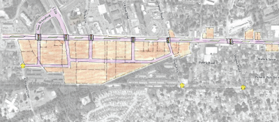
The IHT, somewhat ironically, marks the southern boundary of the bike/ped friendly zone. On the Google Earth screenshot below, the IHT is in blue, the historic downtown is the "A" pushpin, and the No Man's Land is outlined in yellow.


Downtown Danville. 680 runs North to South, from top of image to bottom, respectively.

The zone bordered in yellow could have been an asset, an extension of the historic downtown. Unfortunately, the difference between it and the downtown could not be more stark. Just north of the blue circle, blocks shrink, streets narrow, and stores front the sidewalk. South of the blue circle, the road widens to 4 lanes, (in some cases 5), and parking lots push storefronts back as much as several hundred meters from the (now perfunctory) sidewalk.

From El Nido restaurant to the street is +/- 300 meters

The Livery Mercantile is a lost place entirely: cabin-like shops in various shades of colorless brown held at a distance by a big parking lot forest. I avoid it. It's like, unpleasantly arboreal. Arboreal in the sense that there are no sightlines; it is hard to orient oneself; it is dark; the buildings actually do look like dark huts. Instead of following the predictable geometry of the courtyard/plaza blueprint (see above image; geometric assets aside, it's still just a car-choked variation on a classic pedestrian urban space [imagine filling this with parking, or the Plaza Mayor]), the Livery lot is an amoebic lagoon.

Endor?

So let's be clear: this part of town is not friendly to pedestrians or bikers. If the historic downtown is where people go for a pleasant meal or a shopping stroll, or a midsummer festival, the No Man's Land is where you do the daily errands: Lucky, Walgreens, CVS, McCaulous, multiple banks, etc. The Bowling Alley. So it's a fairly vital part of any Danvillian's weekly life. Except for McCaulous.

If land use patterns made biking safe and desirable, more people would be free to make the choice to deposit checks, pick up groceries, etc, on their bikes. But in a place built for cars, there is only one option: cars. Unless you really enjoy going against the grain, like me.

As much as the land use planning decisions make this a tale of two Danvilles, one for cars and one for bikes/peds(/and cars, too; there really is plenty of parking, proof that you can have it both ways), what really makes the southern downtown a No Man's Land is access. Lack of it: getting to this area from the south, and getting back out of this area to the south present bicyclists with a dangerous set of options that only further discourage anything beside driving.

More on this in the next post.

February 7, 2011

Growth and the Role of Rail

When the cost of HSR is discussed in that way that makes it seems formidably, unAmericanly expensive, the context of HSR's pricetag is rarely established: i.e., that if rail does not happen, many billions will be spent, regardless, on freeways and airports. Obviously, rail does not end the need to spend billions of dollars on roads, freeways, and parking, but it relieves congestion and saves the expenses of expanding those networks. The San Antonio Express-News gets it right:

According to a study commissioned by the Texas Transportation Commission, during the next 20 years, more than $300 billion in 2009 dollars needs to be invested in Texas roads and freeways just to keep commute times from worsening. Adjust that figure for expected inflation and the cost balloons to $488 billion.
The gasoline tax, which provides most of the funding for road construction and maintenance, is expected to provide only $160 billion in revenue during the same period. Legislative leaders have characterized the state's transportation funding as a crisis: Texas is running out of money to build new roads.
California, long maligned as the golden state of governmental malaise, has embarked on a different path. In 2008, California voters approved $10 billion in bonds as a down payment on a $40 billion high-speed rail system that will link San Diego to Los Angeles and Los Angeles to San Francisco and Sacramento via the Central Valley.

Eventually public transit becomes cheaper (and more attractive) than continuing to expand road networks. Los Angeles hit a breaking point: look at the popularity/buzz around Villaraigosa's 30/10 plan to expand transit in Los Angeles. I hope more cities and states see those costs, too, and mobilize in favor of transit.

A good place to start would be spreading an appreciation for the fact that Caltrains saves 2.5 lanes of traffic on 101 during each commute. Is it more expensive to add miles of highway or close a $30 million operating budget for the beleaguered rail agency?

February 3, 2011

Automobile Dependence and the Limits of the Electric Car

Sometimes an argument is taut enough to (momentarily) suffocate any counters. A defense of gay marriage recently accomplished this feat. Below please find its transportation-savvy counterpart.

[He] may well be right that electric cars are the future of the automobile, the ultimate problem isn’t cars themselves—it’s the consequences of a car-centric culture.

Those consequences include, but aren’t limited to: Sprawling development patterns (which are massively energy-inefficient, destroy farmland and rural lifestyles, contribute to the concentration of the food system, and require massive amounts of infrastructure—electrical, sewer, and roadway—to exist), impervious surfaces that increase roadway runoff into streams and soil, car crashes (which kill 40,000 people a year and create a huge cost to public health institutions) the consequences of sedentary, car-based lifestyles (obesity, shorter life spans), and the weakening of ties to friends, family, and community, to name a few.

Publicola author Erica Burnett is responding to the argument that bike and pedestrian street improvements are wasteful and unnecessary because in the future, the climate problem will be solved by electric cars. The electric car meme is tempting, but it only scratches the surface of the lifestyle enabled by the automobile. And while e. cars are certainly a net improvement, climate-wise and oil-dependency-wise, reducing automobile dependence is just as important as reducing fossil fuel dependence.

January 25, 2011

State to Audit Redevelopment Agencies

CA announced today that it will audit redevelopment agencies as part of the information gathering process leading to their elimination or preservation.

Regardless of the fate of these agencies, audits and greater accountability are good. End of story.

January 24, 2011

Should Redevelopment Agencies Get the Axe?

Gabriel Metcalf, of SPUR fame, has a good op-ed defending Redevelopment Agencies.
... it's worth pointing out that we are talking about eliminating the tool central cities use to attract growth that would otherwise go to the suburban periphery.
For me, best outcome of this attn to Redevelopment Agencies will be better oversight. A clipping of wings, not elimination.

Two commenters on this op-ed nicely articulated the pro and con argument for RAs:

Pro:

Dive in deeper to some of San Francisco's large redevelopment projects and you will see that the trade-off Brown is creating between redevelopment and public services is a false one. As part of the Mission Bay deal, private land is being donated to the San Francisco Unified School District for a new public school; funding and construction of a playground accompanying the new school is a required deal point; land and funding is being provided to the City to build a new local fire and police station; space was built to house the first new public library in San Francisco in 30 years. The Treasure Island deal has many of the same public services being supported in its redevelopment program. These are examples of how redevelopment can and should work, resulting in economic development AND needed public services.

Con:

"Used wisely..."

That's the problem Gabriel - they aren't used wisely. The LA Times documented the waste by redevelopment agencies. We've seen redevelopment here in Alameda fund boondogle parking garage projects.
 
The LAT did run an excellent two-part series about redevelopment abuses, and it had an awesome title: Arrested Redevelopment (Links: one and two). LAT also published financial records from city redevelopment agencies to toss some daylight on whether they were meeting their minimum requirements for affordable housing. Great stuff.

But as the first commenter showed, when done right, a redevelopment project will do more than hoard affordable housing monies or build skyscrapers on razed neighborhoods that formerly belonged to low-income people of color.

January 23, 2011

Proposition 26: Negative Fallout

Last fall, CA voters approved Proposition 26, an initiative that requires all new state taxes and fees be approved by a two-thirds majority by each house of the state legislature.

The November passage of Proposition 26 threatens a complicated 2010 gas-tax swap that reinstated California’s transit assistance program.
Since that deal involved an increase to the state’s excise tax, it must be re-enacted with a two-thirds majority of the Legislature, according to Jessica Digiambattista of the Legislative Analyst’s Office.
If the reauthorization is not approved, transit agencies will suffer. The San Francisco Municipal Transportation Agency could lose about $31.5 million and BART about $23 million. Caltrain could miss out on about $4.5 million and SamTrans some $4.6 million.

"[A] complicated gas-tax swap" is right. From what I can gather, it seems like the gas-tax swap reduced the overall funds available to public transit by replacing an out-and-out gas sales tax with an excise tax. Because of Proposition 26, that increase in excise tax must be retroactively approved by a 2/3s majority--irregardless of the fact that it was paid for by eliminating the sales tax. (To keep the gas-tax swap palatable, the overall package is revenue neutral, i.e., no net change in state $$ intake or outflow.)

Madness!

Here's a quick selection of explanatory bits from the Bay Area Metropolitan Planning Commission website. Hard to nushell this one, other than that it seems enabled by imaginative accounting, and is probably motivated by a desire to free up monies in the General Fund. (I also want to guard against the strong possibility that any summary by a non-expert will misrepresent the facts at hand, so I'll let them speak for themselves.)

Mechanics of the Tax Swap

The bills (AB 6 and AB 9) provide the General Fund with approximately $1.1 billion by shifting the cost of debt service on outstanding transportation bonds from the General Fund to various transportation funds. Relieving the General Fund of these interest obligations results in approximately $11 billion in General Fund savings over the next 10 years. 
The tax swap, contained in AB 6, affects four different taxes — the state portion of the sales tax on gasoline, the excise tax on gasoline, the state portion of the sales tax on diesel fuel, and the excise tax on diesel. Local sales taxes remain unchanged and will continue to include gasoline and diesel fuel. AB 6 contains the following key changes:
  • Beginning July 1, 2010, eliminates the 6 percent statewide sales tax on gasoline, and with it, the funding source for Proposition 42 (the 2003 constitutional amendment that required most gasoline sales taxes to go to transportation) and “the spillover,” a funding formula dedicated to public transit.
  • Raises the excise tax on gasoline by 17.3-cents on July 1, 2010, for a total excise tax of 35.3 cents per gallon. Starting March 1, 2011, and each March 1st thereafter, authorizes the State Board of Equalization (BOE) to estimate how much revenue would have been raised by the sales tax on gasoline and adjust the gasoline excise tax to raise an equivalent amount.
  • Retains the existing sales tax on diesel fuel and raises it by another 1.75 percent on July 1, 2011 to generate about $120 million in additional funds for public transit, for a total of approximately $436 million in FY 2011-12.
  • Offsets the diesel sales tax rate increase by lowering the diesel excise tax from 18 cents per gallon to 13.6 cents, effective July 1, 2011. Similar to the gasoline excise tax, the excise tax would be adjusted by the BOE on March 1st of each year to maintain revenue neutrality.

Public Transit Bears the Brunt of General Fund Savings

While the overall tax swap is revenue neutral by design (in order to allow for passage by a simple majority vote), public transit loses over $1 billion annually due to the elimination of the sales tax on gasoline, as discussed in greater detail below. AB 9 also appropriates $142 million in Public Transportation Account (PTA) funds to the General Fund to offset the cost of public transit bond debt service in FY 2009-10 and another $254 million for FY 2010-11.
 ...
AB 9 stipulates how the excise taxes on gasoline and diesel fuel — and the sales tax on diesel — will be distributed, and appropriates $400 million to the State Transit Assistance (STA) program, the only source of state support for public transit operations.

Raw. Deal. Why the gas-tax swap needs reauthorization when it was signed in March of 2010, and Prop 26 was passed in November of 2010, is beyond me.

January 20, 2011

Things You Don't (always) Think About

From a SJ Mercury op-ed about Caltrain's importance to Stanford. Caltrain is facing a $30 million budget shortfall next year.

Losing Caltrain service would cripple our regional transportation system and economy, limit mobility and employment options and require 2.5 additional highway lanes between the South Bay and San Francisco to keep the commute flowing at current levels, according to UC Berkeley professor of city and regional planning Elizabeth Deakin.

I think we can all agree that adding a minimum of 24 feet to several hundred miles of freeway (hundred: there are multiple freeways serving the 50 mile stretch between SF and SJ, 280 and 101 being foremost) would cost substantially more than $30 million. Just sayin.

Glad to see that Stanford is getting ink for leading the charge to find Caltrain funding.

Ascertainable Fact: Sprawl Neither Demanded nor Profitable

Not demanded:

(From the WSJ. Italics mine. Bolding mine. Underline mine.)
Much of this week’s National Association of Home Builders conference has dwelled on the housing needs of an aging baby boomer population. But their children actually represent an even larger demographic. An estimated 80 million people comprise the category known as “Gen Y,” youth born roughly between 1980 and the early 2000s. The boomers, meanwhile, boast 76 million. (And, uh, we're gonna outlive them.)
Gen Y housing preferences are the subject of at least two panels at this week’s convention. A key finding: They want to walk everywhere. Surveys show that 13% carpool to work, while 7% walk, said Melina Duggal, a principal with Orlando-based real estate adviser RCLCO. A whopping 88% want to be in an urban setting, but since cities themselves can be so expensive, places with shopping, dining and transit such as Bethesda and Arlington in the Washington suburbs will do just fine.

Count me in that 88%, obvi. I'm wracking my brain for a peer to (anonymously) trot out as a counterexample, but I can't.

Not Profitable:

Transportation for America breaks down a report indicating that these Gen-Y preferences (density, infill, transit-links, walkability) have big economic bonuses:

In Dallas, Texas, for instance, downtown retail sales rose 33 percent the year after the new light rail system began operation. Portland, Oregon attracted $3.5 billion in private investment after just $100 million in streetcar funding. In Sarasota, Florida, downtown development costs clocked in at just half the cost of new development in the suburbs and generated four times the revenue in tax receipts.
Denver, Colorado perhaps best exemplifies the market for new approaches to growth and transit. Home values for Denver residents within a half-mile radius of the Southeast light rail line increased by 18 percent just as home values in the remainder of Denver declined by 18 percent, between 2006 and 2008. Nationwide, one study found that every one-point increase in a home’s “walk score” — a measure of how accessible the area is by foot — corresponded with a $700 to $3,000 increase in property value.

January 18, 2011

Bike Advocacy in LA

The Los Angeles County Bike Coalition City of Lights program is spearheading bike education, safety, and advocacy projects on behalf of immigrants in Los Angeles--a largely car-free population. De-gentrifying the bike with outreach

Allison Mannos nails it--halfway thru the vid:

Toward More Reliable Financing for Mixed-Use Development?

Not out of the woods yet, but it appears momentum is growing to create a more reliable source of funding for mixed-use developments. An alphabet soup coalition of National Association of Home Builders (NAHB), Congress for the New Urbanism (CNU), and the National Town Builders Association (NTBA) is pushing for Fannie, Freddie, and HUD to guarantee mortgages for a more diverse, incl. mixed-use, portfolio of real estate. 

A Big Urban Victory – Mixed-Use and Fannie, Freddie and the FHA
The board of the National Association of Home Builders (NAHB) has approved a resolution that could have a dramatic impact on urban mixed-use, Main Streets and good development overall. In a partnership with the Congress for the New Urbanism (CNU) and the National Town Builders Association (NTBA), the resolution by NAHB supports reform of Fannie Mae, Freddie Mac and the Federal Housing Administration’s guidelines for mixed-use development.


Currently, Fannie, Freddie and the FHA will not guarantee a mortgage on a development or building that is more than 25% commercial space. The resolution would raise that limit to 45%. This is significant because historic Main Street districts and new infill development would be suddenly eligible for significant new investment opportunities.

Streetsblog Capitol Hill has more:

Urbanists have won an important victory in their campaign to reverse Fannie Mae and Freddie Mac’s bias against mixed-use development, enlisting the National Association of Home Builders to help push for a critical reform to Fannie Mae and Freddie Mac’s lending standards. The mortgage giants currently require that projects they finance be no more than 25 percent commercial (20 percent for Fannie and for multifamily HUD projects.)

The Congress for the New Urbanism has waged a battle against these mandates. “Every Main Street in America violates Fannie Mae’s and Freddie Mac’s rigid standards,” CNU President John Norquist has said.

According to CNU, Fannie and Freddie’s commercial-space maximums have had “a distorting effect on building types and development patterns,” especially disadvantaging low- to mid-rise buildings with retail on the first floor and apartments or condominiums above. “Before these regulations, low-mid rise mixed use buildings were common.”

January 17, 2011

Salem Photo-Essay: Bike Racks

Our Chief Bike Infrastructure Photography Editor, Pacific Northwest Division, AKA MRE, has turned in an eagle-eyed debut.

Below please find some quite wonderful bike racks Our Correspondent noticed whilst perambulating scenic downtown Salem, OR.

Proof that bike racks can be an enlightening, amusing part of the small-town streetscape, though some will inevitably disagree and move to convene task forces debating the issue.


Statue of Liberty

I think that every coffee shop should have steaming-coffee-cup shaped bike racks.

Some cursory internet searching turned up some other interesting examples. Courtesy of David Byrne (of Talking Heads fame), the following were temporary additions to New York City sidewalks:


Seriously: bike racks could be a great way to accentuate a business's street/sidewalk presence. And provide bike parking, and public art.

January 15, 2011

Planners vs. Pre-Fab in the Olde Sod


In the waning months of World War II, England built hundreds of pre-fab homes that were intended as only as temporary housing. Many of these neighborhoods were replaced within 20 years by Le Corbu inspired concrete towers, which, of course, were about as pleasant to look at and live in as a bag of hammers.

One neighborhood, the Excalibur Estate, has persisted, but a local council has redevelopment in mind for the 20 acre site: something on the order of 400 homes. (I found this amount perplexing, given that there are 187 prefab home/garden units there currently.)

The article has a definite NIMBY bias, given the historical role the prefab homes played for WWII vets, and given the natural human indignation summoned when a bureaucracy declares it can and will buy your home, demolish it, and rebuild under the aegis of a "Sustainable Community Strategy."

Related: Human Transit had a great post about the semantic importance of reporting both sides of story. This article fails that test, and as a result makes vilifying the cruel bean-counting central planners a very tempting activity. Am trying to resist without knowing more.

January 13, 2011

Public Transit, Public Space, and the Ghost of Johnny Cash

This guy!


Deserves all the recognition he gets. Sounds even better in person. (h/t ZS).

And that moment at the end of the clip, when he recognizes the connection made when he creates a smile: amazing. And the reason why public space and public art are vital, and environments sans either are rather life-denying.

In a station of the metro

The apparition of these faces in the crowd;
Petals on a wet, black bough.

The woman who drives the route 21 southbound bus that arrives at Railroad and San Ramon Valley Blvd at 7:55, weeknights, has the nicest smile of any bus driver in the Bay Area. She doesn't say anything, but she always smiles. I only ride that route once, maybe twice a week--only when my tutoring sessions at the Library end at 7:40ish--so I have yet to ask her name. But I think we recognize each other now; I always board at the same stop.

My sister has just pronounced riding the bus in Danville, "weird." This from a young woman who rides the bus on a mostly weekly basis in Salem, Oregon, where she is a carless college student with an off-campus internship. And her mindset is common, perhaps endemic in car-dependent places like Danville, where children are raised in the backseat of automobiles. That's what I was used to; I had never set foot in a Danville bus before last August and the thought of waiting at the bus stop, or of actually being a bus rider (who are those people!) gave me the howling fantods. Especially the kids who used to take the bus to school. They were a tainted race. Habits! Habits die-hard.

The 21 driver picking up at BART at 6:00 asks his regulars: "did you leave a phone on the bus last night?" Dissenting answers. The time nears 6:00, one more man boards, and the answer is "yes!" An explosion of good cheer as giver and getter of good deed meet.

According to my dentist, I am truly my "father's son" because we are the only two patients who ever bike to appointments. I feel like a role player in an ensemble cast. "The bike guy." Better: "Biking son of biking dad." My students think of me that way too, as some kind of interesting local flavor: perplexed that I ride the bus, astonished that I bike so far! (3 miles) when it is so cold! (like 40). But then they soften it with, well, it probably saves money on gas. And I add, I like to read and doze on the bus. Hmm, they say. Yeah.

A man sitting behind me on the bus ride home (woman with the smile at the wheel) answered his phone. "Hello. I'm on my way. I'm doing the best I can so don't bitch at me thank you bye bye."

January 9, 2011

Transforming a City

If you have 25 minutes, this PBS documentary about the work and legacy of Enrique Peñalosa, former mayor of Bogatá, is well worth a watch.

Transportation investments under his watch have improved the quality of life and reduced the crime rate for a city that used to be synonymous with danger and drug cartels.

Watch the full episode. See more e2.


Before the video starts there are 2 short ads ... do not lose heart! Plus, Brad Pitt narrates.

January 7, 2011

Streetscape Designs

I love streetscape design. The constraints are concrete (pun?): a travelway of x ft across, including sidewalks ... and a question: how to use it? I've been wanting to write a post titled something like "Anatomy of a Streetscape" for a while, and while this is not that post, it is as useful an introduction as any.
Cesar Chavez Street, six lanes of asphalt that's the dividing line between the Mission District and Bernal Heights, is about as close as it comes to a freeway while still being a city street.
But unlike a freeway, it's surrounded by housing, schools, a church and a smattering of businesses. Now it's the latest city street in line for a major transformation to make it more inviting to pedestrians and bikes.

The plan calls for narrowing the street from six lanes to four, with left turn lanes at major intersections, adding bike lanes in both directions, widening and landscaping the median, planting more than 300 trees along the corridor and installing energy-efficient lighting.
The design calls for two pedestrian plazas, at Mission Street near Capp Street, and at Precita and Bryant streets; widening the sidewalks at the corners; shoring up and adding curb ramps; and putting in planters to capture storm water.
In addition, the sewers will be upgraded and the stretch between Hampshire Street on the east to Guerrero Street on the west will be repaved.

I've written before about how grade school parents make an excellent constituency for pedestrian and bicycle infrastructure enhancement (Safe Routes to School, etc), and a few of the proponents quoted in the article were parents and grandmothers. Indeed, the movement for redesign started with a neighborhood petition in 2006.

In addition to organizing parent of gradeschool children, another tactic for creating more sustainable, complete streets is to run traffic counts. Engineering standards are prescriptive in the way they seek to create streets for specific capacities of automobile throughput. If streets see less traffic, there is a quantitative argument to be made that a travel lane for cars might be better used for median expansion/beautification, wider sidewalks, or a bike lane.

Given the amount of traffic on Cesar Chavez--50,000 cars/day, and its connection to 101--underuse was probably not a very useful argument. More info about Cesar Chavez redesign,

Starting a redesign as a pilot/temporary change is another way to get opponents to test run an idea. See the success of the re-timed traffic lights on Valencia Avenue. The green wave may not technically be streetscape/infrastructure, but it nonetheless directly affects the street environment.

Here's an article about similar plans for the Masonic Streetscape. Love looking at aerial diagrams like this one:

January 4, 2011

Effort vs. Inequity in New Orleans

Exhibit A: Selection from an excellent profile of New Orleans community organizer/pillar of strength, Jenga Mwendo (via Grist).

Capsule summary:
The Lower Ninth Ward was the hardest hit by Hurricane Katrina, with floodwaters surging over the nearby Industrial Canal. Jenga Mwendo calls the Lower Ninth a "community of survivors." Only an estimated 25 percent of residents have returned. As a result, a sort of stand-off has occurred: businesses won't come until the population increases, but the population won't increase without even basic amenities. There is currently only one school and not a single produce-stocked grocery store there.
Mwendo, 32, was living in New York City and working in computer animation when Katrina struck in 2005. She moved back to rebuild her house, and then started on the neighborhood. In the past few years, she's revitalized and built two community gardens, launched the Backyard Gardeners Network, and facilitated the planting of 175 fruit trees for homeowners throughout the Holy Cross historic district in the Lower Ninth. She's also launched a vegan catering business.
Exhibit B: Selected entries from Harper's Index.

From the 12/2010 issue:

Value of economic-recovery bonds the State of Louisiana has sold since Hurricane Katrina: $5,900,000,000
Percentage of the revenue that has been spent on projects in New Orleans: 1
Percentage spent on the Lower Ninth Ward: 0

To paraphrase Huck Finn, it's enough to make a body feel real mean low-down and ornery. The raging inequity! On the one hand, the story of an individual meeting a challenge and filling a void that might not otherwise be filled is inspiring. A real be-the-change-you-want-to-see-in-the-world moment. On the other hand, the glaring absence of state (and federal, for that matter) support is unacceptable. What gets me is that sinking impression of "if she weren't doing something, would anyone?" (Yes, but ...) Because elected officials aren't picking up any slack, or spearheading any (re)investment.

In an ideal world, Ms. Mwendo would be doing her outstanding work amid a crowd of other state-funded initiatives, and would hopefully receive a portion of that funding to scale up her work.

NB Harper's Index archives are (practically) infinite and searchable.