Showing posts with label Public Transit. Show all posts

March 15, 2011

Transit Tensions: Development Enhancer, or Mobility Tool?

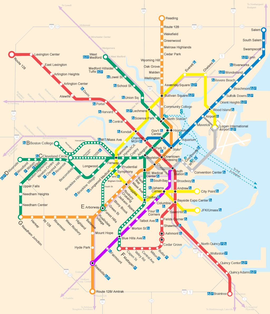
I hope my professors will let me submit light rail prospectus analysis in multimedia:


An excellent series of accompanying blog posts at Transport Michigan gets to the heart of the issue:

Over the past decade, developers and city officials across the U.S. have taken an interest in downtown streetcar systems as a development tool. The model was the Portland Streetcar, opened in 2001 as a 2.4-mile loop connecting downtown Portland to a former industrial area just to the north. Rechristened the "Pearl District," that area boomed with new luxury lofts drawing Portland's growing professional population. Ironically, just as housing developers extended streetcar lines out to posh new residential districts a century ago (Woodbridge in Detroit is one such "streetcar suburb"), streetcars now offer cities and developers a potentially lucrative tool for facilitating the return of well-heeled residents back into the inner city. Transit advocates have long sought transit-oriented development to increase ridership, but streetcar advocates flip the phrase, proudly calling streetcars "development-oriented transit," although some Portlanders complain the district has grown too "hoity-toity" for their taste.
...
On a more fundamental level, though, when we lack regional rapid transit, and tens of thousands of transit-dependent Detroiters have to rely on unreliable, infrequent buses to get around, is it really appropriate for us to put real estate development that primarily serves newly arrived professionals before meeting the transit needs of the entire region, and especially those of the less privileged? This author's status as a twenty-something white guy from an affluent, educated background makes him a strong candidate for being one of those professionals, and I'm all for more housing in Cass/Midtown (though I think it's vital for it to be mixed-income), but I still think regional transit has got to be first.  [bold mine]

Mobility is part of equity. Planning for streetcars with local stops designed to spur development and boost property values without a pre-existing regional transit network smacks of boutique transit. Transit can have positive externalities, but only when it helps people get from point A to point B.

The issues of privilege, gentrification, and which needs transit serves are certainly at issue here, but equity concerns are not the only ones. A streetcar with an overly local focus, in the absence of good regional services, runs counter to the forces that generate lively and diverse city blocks: letting people move freely about the city. Cities are great because they have a wealth of different activities housed cheek and jowl: opera, sports franchises, boutiques, professional services, offices, residences. Attempts to cluster these into zones usually leads to a breakdown of the very diversity that generated the foot traffic that generated the diversity, you dig?

Human Transit recently weighed in on the importance of mobility vs. local place-making. The two elements should balance each other in any self-respecting city: the former about passing through, the latter encouraging staying around.

The trick is the dialog: keeping that pendulum balanced between transit that encourages people to, say, take the streetcar for all their local errands, and transit encouraging mobility. These are not mutually exclusive functions, but recognizing the different motives behind transit projects helps avoid imbalances. Too far to the local, and isolation/stagnation can ensue. Too far to the mobile, and you have a land of no-places (see auto-dependent freeway suburbs with replicated chain stores surrounding parking lots off 6 lane median-less arterials for what maximum mobility looks like).
The late 20th Century car-centered model led to the massive conversion of land area from placehood functions to mobility functions.  Transit's great virtue is that it provides a lot of mobility using relatively little space, so that more area can be devoted to places, both public and private.  ...
There is a strong current in New Urbanism, not without detractors, that does seem interested in abolishing mobility.  Patrick Condon's idea for Vancouver, for example, would cancel a single proposed subway line and instead replace all of the city's electric trolleybuses with streetcars that go the same speed as the buses do.  He would cancel a mobility-improving project and instead spend money in way that that may do great urban things but doesn't increase mobility at all.  Once his network was complete, nobody could get anywhere any faster than they can now. 
This makes sense only in a context where going places (even under renewable elecric power) is an objective evil.  Streetcars, in this vision, supposedly cause greater urban density to be built at livable neighborhood scales, so that people meet more of their needs close to home.  People spend most of their time in their own "villages" and others nearby.  They simply do not travel far across the city, and had better not be in a hurry when they do.
It's understandable that "urban village" is a winning concept right now.  We do need to increase the self-reliance of each part of a city, so that travel demand for many of life's needs can met closer to home.  The pendulum swung far the other way in the late 20th century, toward surrendering placehood to movement.  I support and eagerly participate in efforts to help it swing back.
But I think we can see what it might look like to swing too far in the new direction.  We stay close to home, and thus evolve transport systems that are useful for going short distances and useless for going long ones.  And the obvious retort to this is:  In that case, why live in a city?  Why not just live in a country village, or in a small city?

March 11, 2011

Caltrain Saved, For Now

Chronicle reports: Caltrain has found a way to stay afloat for the next two years. The Metropolitan Planning Organization, the closest thing the balkanized Bay Area transit/transpo landscape has to a arbiter, stepped in and pledged to divert monies slated for maintenance projects (!) and capital projects like electrifying the Caltrain tracks (who knew?) and building a "Dumbarton Bridge line." Again: who knew.

And raise fares. Natch.

And to think people thought Caltrain would stay solvent by closing stations or limiting hours.

It's hard to tell from either the Chronicle or the Examiner account whether the diverted funds are the MTO telling Caltrain what to do with its (Caltrain's) money, or whether it's the MTO throwing its own money at Caltrain. I lean toward the latter. The plan is for Caltrain to locate a dedicated funding source in the next two years--it is unique among all Bay Area transit agencies in lacking some kind of local tax revenue source. Because the current arrangement is hardly appealing, for anyone. And one of the craziest things is that Caltrain has one of the highest farebox recovery rates in the area; they get more of their budget from fares sold than BART or Muni do. Through the looking glass.

At least the new Transbay Terminal has some sweet public art commissions lined up: Tim Hawkinson plans to use rubble from the old Transbay Terminal to make a new sculpture. Previous work:

 
A bear!
And a "300-foot long sculpture was comprised largely of 13 bus-sized inflated bags", AKA a giant bagpipe.

March 9, 2011

Dept. of Fun Things to Do at a Bus Stop

Earlier this year, Clear Channel ponied up to install digital screens at 20 different bus stops across San Francisco. Like, big digital screens.

Clear Channel's incentive: advertising revenue. Clear Channel shoulders the implementing costs, pays Muni for the bus stop space, and then rents out the screens to companies like Yahoo, which sponsored a month-long Bus Stop Derby. While waiting at bus stops, patrons could tap-activate the touch screen, sign in as a representative for x neighborhood, and play live games against people at other bus stops. The winner accrued points for his/her neighborhood, and ... one month later, North Beach has been crowned victorious (tourists?), followed by the Tenderloin. I have this image of legions of bums (with, you know, lots of free time), gradually ascending the digital learning curve and accumulating points by virtue of sheer hours played.

Anyway, something worked, because Clear Channel is expanding the digi-screens to DC.

Big screens, yo. And I'm stuck with County Connection, where you're lucky to have a bench.

Locations of the different interactive bus stops. Even though most sites are concentrated in the Financial District, players anywhere can sign in for any neighborhood.

January 23, 2011

Proposition 26: Negative Fallout

Last fall, CA voters approved Proposition 26, an initiative that requires all new state taxes and fees be approved by a two-thirds majority by each house of the state legislature.

The November passage of Proposition 26 threatens a complicated 2010 gas-tax swap that reinstated California’s transit assistance program.
Since that deal involved an increase to the state’s excise tax, it must be re-enacted with a two-thirds majority of the Legislature, according to Jessica Digiambattista of the Legislative Analyst’s Office.
If the reauthorization is not approved, transit agencies will suffer. The San Francisco Municipal Transportation Agency could lose about $31.5 million and BART about $23 million. Caltrain could miss out on about $4.5 million and SamTrans some $4.6 million.

"[A] complicated gas-tax swap" is right. From what I can gather, it seems like the gas-tax swap reduced the overall funds available to public transit by replacing an out-and-out gas sales tax with an excise tax. Because of Proposition 26, that increase in excise tax must be retroactively approved by a 2/3s majority--irregardless of the fact that it was paid for by eliminating the sales tax. (To keep the gas-tax swap palatable, the overall package is revenue neutral, i.e., no net change in state $$ intake or outflow.)

Madness!

Here's a quick selection of explanatory bits from the Bay Area Metropolitan Planning Commission website. Hard to nushell this one, other than that it seems enabled by imaginative accounting, and is probably motivated by a desire to free up monies in the General Fund. (I also want to guard against the strong possibility that any summary by a non-expert will misrepresent the facts at hand, so I'll let them speak for themselves.)

Mechanics of the Tax Swap

The bills (AB 6 and AB 9) provide the General Fund with approximately $1.1 billion by shifting the cost of debt service on outstanding transportation bonds from the General Fund to various transportation funds. Relieving the General Fund of these interest obligations results in approximately $11 billion in General Fund savings over the next 10 years. 
The tax swap, contained in AB 6, affects four different taxes — the state portion of the sales tax on gasoline, the excise tax on gasoline, the state portion of the sales tax on diesel fuel, and the excise tax on diesel. Local sales taxes remain unchanged and will continue to include gasoline and diesel fuel. AB 6 contains the following key changes:
  • Beginning July 1, 2010, eliminates the 6 percent statewide sales tax on gasoline, and with it, the funding source for Proposition 42 (the 2003 constitutional amendment that required most gasoline sales taxes to go to transportation) and “the spillover,” a funding formula dedicated to public transit.
  • Raises the excise tax on gasoline by 17.3-cents on July 1, 2010, for a total excise tax of 35.3 cents per gallon. Starting March 1, 2011, and each March 1st thereafter, authorizes the State Board of Equalization (BOE) to estimate how much revenue would have been raised by the sales tax on gasoline and adjust the gasoline excise tax to raise an equivalent amount.
  • Retains the existing sales tax on diesel fuel and raises it by another 1.75 percent on July 1, 2011 to generate about $120 million in additional funds for public transit, for a total of approximately $436 million in FY 2011-12.
  • Offsets the diesel sales tax rate increase by lowering the diesel excise tax from 18 cents per gallon to 13.6 cents, effective July 1, 2011. Similar to the gasoline excise tax, the excise tax would be adjusted by the BOE on March 1st of each year to maintain revenue neutrality.

Public Transit Bears the Brunt of General Fund Savings

While the overall tax swap is revenue neutral by design (in order to allow for passage by a simple majority vote), public transit loses over $1 billion annually due to the elimination of the sales tax on gasoline, as discussed in greater detail below. AB 9 also appropriates $142 million in Public Transportation Account (PTA) funds to the General Fund to offset the cost of public transit bond debt service in FY 2009-10 and another $254 million for FY 2010-11.
 ...
AB 9 stipulates how the excise taxes on gasoline and diesel fuel — and the sales tax on diesel — will be distributed, and appropriates $400 million to the State Transit Assistance (STA) program, the only source of state support for public transit operations.

Raw. Deal. Why the gas-tax swap needs reauthorization when it was signed in March of 2010, and Prop 26 was passed in November of 2010, is beyond me.

January 13, 2011

Public Transit, Public Space, and the Ghost of Johnny Cash

This guy!


Deserves all the recognition he gets. Sounds even better in person. (h/t ZS).

And that moment at the end of the clip, when he recognizes the connection made when he creates a smile: amazing. And the reason why public space and public art are vital, and environments sans either are rather life-denying.

December 11, 2010

Bikes in Rush Hour

Hat tip to CH for the following:


Bike Computer Study Proves Rush-Hour Cycling Is Faster Than Driving

The title might be a bit misleading, because the study is only concerned with the city of Lyon, France. The Velo'v bikeshare program there enjoys robust ridership, and now has data to show that using it is the most efficient means of transportation during rush hour.
According to MIT's Physics arXiv Blog, the average speed of cyclists was approximately six miles an hour (the average inner city car speed in Europe). But during rush hour, cyclists traveled faster, at an average of nine miles an hour, beating local vehicles. For the first time, researchers have confirmation that cyclists pedal faster between 7:45 am and 8:45 am on weekdays, suggesting a rush to get to work.
Cyclists went especially fast on Wednesday mornings. This is probably a quirk of French culture, according to the researchers; women often stay home to take care of kids on Wednesdays, so the bike pool is mostly composed of men, who pedal more quickly.
The fact that the data showed average faster speeds on Wednesdays due to higher proportions of male riders is simply outstanding. Data!

And crazily enough, Lyon doesn't even have bike lanes--which seems incongruous in light of how successful its bike share program is. I am not familiar with the city at all, so perhaps the streets are such that bicyclists do not feel as threatened as I do when biking on bike lane-less city roads in Boston or San Francisco. The article suggests that cyclists use the bus lane, which if properly separated from car traffic, could be quite useful.

And on the comments board, a reader made the claim that Top Gear, the BBC automobile TV show, knew about the bicycle advantage years ago. As a longtime fan of Top Gear, I investigated. The following episode originally aired in November of 2007, and featured a race across rush hour London. The contestants: a bicycle, a car, public transit, and a speed boat. Skip to half way through the video, and enjoy.


Top Gear Season 10 Episode 5 - Full 'Epi

November 29, 2010

Department of Pipe Dreams: Highway 680 Bus Rapid Transit, Pt I

Making fantasy transit maps is a favored pastime of at least a few urban planning bloggers, but I must confess this pipe dream was dreamed well before I read about Transbay's dream Bus Rapid Transit plans, mega MTA, or a Boston with an MBTA urban ring. Goes to show that fantasy is a standard, and seductive, business.

In this post I'll give a general overview of why a BRT line linking West Dublin/Pleasanton BART and Walnut Creek BART in the Highway 680 right of way would be a good idea, if wishes were horses. In Part II, I'll go into more detail about Bus Rapid Transit particulars, individual station locations and treatments, what kind of feeder bus networks would be needed, and what incentives and enhancements could boost hypothetical ridership.

The Pitch

Interstate 680, north of 580 and south of 24, is clogged with traffic, especially during commuter rush hour. Large sections of it are built out, making expansion difficult. The Walnut Creek BART Station in the north and Dublin/Pleasanton Station in the south take commuters into Oakland and San Francisco, but full parking lots and underused buses limit station capacity. The area in between the stations is a transit desert, served only by a scattering of County Connection bus lines. These bus lines already use the two BART stations as convenient route termini, but rely on the anonymous, tucked away, San Ramon Transit Center for their origin. Housing developments and sprawl continue at the edges of existing development, further impacting 680. Cities and towns surround 680, yet the corridor lacks density or sheer population to justify a BART connection. (BART is already in trouble for expensive boondoggles, landing on the wrong side of violent and financial civil rights disputes, and being politically obligated to build out to inefficient locations because those locations happen to contribute revenue to it.) 680 is the principal artery for the region, a necessity to get to either BART station, anywhere else in the Bay Area, and many local trips.


BRT on 680 would fill in the gap between D/P and Walnut Creek

Note how developments are concentrated around 680, but spreading eastward in San Ramon/Danville. BART Stations are located where 680 and 24 intersect in Walnut Creek, and 680 and 580 intersect in Dublin.


The Overview

Bus Rapid Transit for the 680 corridor would link the under-construction West Dublin/Pleasanton BART Station to the Walnut Creek Station. It would have its own dedicated right of way for the duration of the route, off board fare collection, and triple-door low floor buses (or raised platforms) to facilitate minimal holding times at stations. To cater to business commuters, the buses could offer wireless internet. Stations will be built around intersections where 680 crosses over or under major suburban arterials.

Like this, Transmilenio style (BogotĆ”, Colombia)

Investing in the highway right of way would centralize and reorient bus operations into a main trunk route fed by feeder buses. Feeder buses would run along the high-volume arterials that traverse the region--streets like Crow Canyon, Bollinger Canyon, Ygnacio Valley, and Stone Valley Roads. Users would need to get to the nearest arterial, and from there, using the system would intuitively mimic how they already move around the region: accessing and exiting 680.

While BRT could certainly be used for a variety of daily trips, its largest value-add will be for commuters traveling out to Oakland and San Francisco, or commuters coming in to the office parks in San Ramon and Pleasanton. BRT's guaranteed traffic-free ride to BART will reduce incentive to both a) drive to BART, and b) drive to the final workplace destination, taking cars off the road and diminishing rush hour traffic.

Stay tuned for the list of stations and locations of feeder routes!

November 17, 2010

Sprawl Repair

I wouldn't mind being Daniel Jarrett ... for a day ... or more ...

Because this is excellent.

Transit's Role in Sprawl Repair

" ... since government has much more direct control over the street than over the development parcels, we might move faster on sprawl repair if we focused on the arterial first, or at least at the same time."

He takes Fresno as an example--it has a massive road network largely dominated by arterials, and it does not face significant congestion challenges. Here's a sample pitch that he would deliver to local officials:

" 'What if we learned from Los Angeles's path?  Instead of waiting until it's really expensive, as Los Angeles did, what if we take early, gradual, inexpensive steps to make our arterials safe and attractive for transit?  That doesn't mean ripping up our single-family neighborhoods, but it does mean rethinking our arterials so that they're safe and attractive places for pedestrians, and so that they provide appropriate levels of priority to transit.  We don't need transit to be attractive to everyone, we're not 'forcing' people to use it, but it could attract people who already want alternatives to driving.  Let's face it, a lot of our citizens are struggling on low incomes, and cars are expensive.  Many families would experience sudden improvements in wealth if they could get rid of one or more of their cars.'

'So we need to gradually repair our sprawl.  That doesn't have to mean big increases in density.  We'd build some denser centers for people who want a more urban life, but we're not going to build townhouses in your back yard -- or at least not until you and your neighbors want us to.  Mostly, we just need to stitch things together so that people can walk and cycle more safely, both to complete local trips and to get to transit stops.  It means making sure that at every transit stop, there's a protected way to cross the street, because you can't use transit for a round trip unless you can use stops on both sides of the street.  It means adding pedestrian links to cul-de-sac neighborhoods, so that they are through-routes for bicycles and pedestrians while remaining cul-de-sacs for cars.  And it means making sure that the design of bus stops and transit priority conveys a clear message that transit riders are valued as citizens, and appreciated for the contribution they make to a sustainable and functional city.' "

November 16, 2010

SF Pulling Out All Stops

Two proposed underground subway lines into downtown.

Congestion pricing for SF's northeast quadrant.

Parking lot in the Mission slated to become a park.

MTA proposes 250 miles of bus only lanes, 100 miles of dedicated bike lanes.

And a month ago, SF Bike Coalition's plan for major, city-wide bicycle infrastructure, striping, and safety improvements.

Topsy-turvy up in here. Exciting to think about how these projects could transform the city--if any of them come to pass.

(Duplicate?) Underground Rail Galore Planned in SOMA, South Beach

The San Francisco MTA is looking a few million short for their planned central subway. The subway would connect the existing Caltrain terminal at King and 4th with light rail service above ground to Bryant and 4th (by the looks of the map) and then underground to Chinatown.

The proposed additions

What is unclear is how this plan will connect with the Transbay Terminal, a project that is much more likely to move forward, since the previous Terminal has been demolished--buses are currently using a temporary structure. According to the Transbay Terminal project map (also below) on the website, the new Terminal will be bounded by Mission and Howard, and 2nd and Beale. So, far enough away from the black line on the above map that the central subway will not pass through the Transbay Terminal.

Additionally, the Transbay Terminal proposes building an underground right of way from King and 4th to the 2nd and Howard/Mission. This would serve as the SF terminus for high speed rail.

"The rail line will be extended 1.3 miles underground from its current terminus at Fourth and King streets into the new Transbay Transit Center, providing a seamless connection between the Peninsula, the South Bay, Southern California and San Francisco’s Financial District."

So to pull this together: HSR and Caltrains will come through the 4th and King station, and continue underground to the Transbay Terminal (blue line above). The 4th and King station will also have a branch northwest along 4th street, taking Muni light rail aboveground to Bryant, then underground to Chinatown.

I wonder how the underground subway would connect with existing Muni subway running along Market Street ... (update: commenter lmz informs that the Union Square Central Subway stop would have an underground ped connection to the Powell St station)

Also, can a high speed rail train execute a 90 degree turn? Maybe the right angle is an exaggeration of the publicity map; these are obviously not engineering specs, and it will be underground in any case (and thus not constrained by street grids).

Both of these projects are "actively searching for funding." Especially the central subway, which is more tenuous. If rail service is already being extended from 4th and King to 2nd and Mission, does it also need to go up to Chinatown along a separate route? Wouldn't it be better to extend, later, northward from the Transbay Terminal? I must be missing something here.

November 11, 2010

SPUR Lunch Talk: CA High Speed Rail and Land Use

The San Francisco Planning and Urban Research group (SPUR) hosted a lunch forum today in which it presented 13 recommendations for land use plans around future/hypothetical CA high speed rail stations.

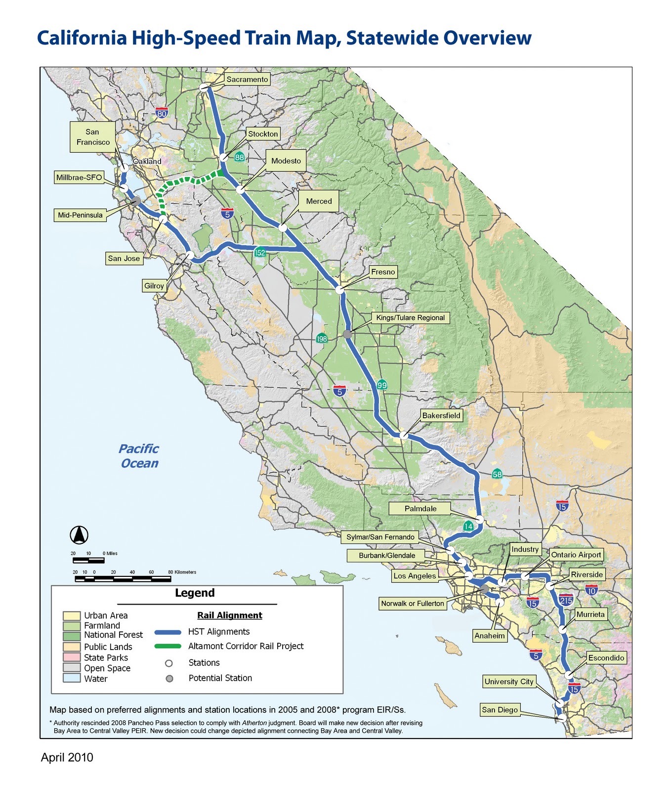
A fully funded network will have 26 stations, serving cities that contain the vast majority of the state's residents

After a general overview of HSR, and some caveats--these recs are "bird's eye view," they won't get into specifics of station design, alignments, etc--Regional Planning Director, and chief powerpoint clicker Egon Terplan got down to business. The recommendations turned out to be fairly unsurprising, at least for anyone familiar with the work that SPUR does, yet certainly good, worthy, and salient. The presentation left me hankering for a longer format presentation, one that would delve into the site-specific details of individual station areas. That's where the real creative/pragmatic alchemy would be, not in a list of general principles--I mean, find me a planner who would disagree with making the area around the station a "destination." Nonetheless, general principles are critical for establishing goals and expectations, so it's worthwhile to lay them out. Rather than reproduce each of the 13 recs, I'm condensing them, because let's face it, I've never been the linear note-taking type.
  • Station Area Plans for each of the 26 HSR station areas. Density minimums, parking maximums, integrated access to intermodal feeder networks.
Station Area Plans are the necessary starting point for generating maximal utility from each station. As SPUR noted, it is perfectly conceivable for HSR to follow the footsteps of BART, or airports, and become functioning transportation hubs surrounded by surface level parking and other low-rise, low-density uses. This would be counterproductive in several ways.

One, it forfeits HSR's unique ability to create incentives for denser developments, essentially giving up the potential for concentrated investment in what will typically be the city's downtown area. Two, denser uses around the station ensure higher station use: more office space, more commercial space, convention centers, high(er) rise residential will make HSR more relevant. Third, using the space around the station intensely, but also with an eye toward public spaces and the unique dimensions of each city will create good urban places. Good urban places will increase the feedback loop of investment and HSR ridership. Fourth, development at each station will help prevent the system from making CA into one big commutershed. Surrounding a station with parking and low-rise residential will only encourage riders to use HSR as a commuter train on steroids, and extend the bedroom communities of SF, SJ, and LA into the central valley. Some movement in that direction will undoubtedly occur, but far better to work toward making those places destinations and job sources in and of themselves.

Not this: North Berkeley BART

Not this either: Oakland Airport. The "A" placemarker is in the middle of a parking lot

Terplan also noted that in France, many cities lacked light rail before TGV stops were built. Presence of TGV spurred investment in local links and feeder routes, dramatically increasing the connectivity of the area as a whole, above and beyond simply getting to and from the station. An HSR station would certainly require re-jiggering local transit routed, and I'm hopeful that this could lead to some new investments and transit ridership.

A problem is that the state of CA lacks either the political will or the legal authority (different opinions were offered on this point) to mandate station plans, which leads to:
  • Financial incentives for local governments to make Station Area Plans: Matching grants, Revolving loans.
Funds are always hard to come by, but plans have the advantage of being relatively cheap. Terplan singled out general obligation bonds like Prop 84 from a few years back as initiatives that could tuck away the $1 million or so necessary for a good plan. Takeaway here is that sans incentives means cities sans resources for far-reaching plans.
  • Incentives for the type of Station Area Plan SPUR favors: TIF for TOD
Little as the state can dictate what a municipality must plan, it has less control over how it should plan. (An interesting comparison here, to Japan, where the company unrolling the HSR there also had a real-estate development arm that got to plan areas around the station just how it wanted. Nice.) Tax Increment Financing (TIF; TOD stands for Transit Oriented Development) is a tool I've already documented, and certainly a way for cities to capture the value of HSR. Read: shake the money tree. Only problem is, in order to establish a TIF zone, you need to show evidence of blight. Terplan mentioned that a few years ago there was a drive to introduce legislation that would classify HSR stations as sufficient grounds to create a TIF zone. Were this to be revived and passed, public and private bodies would have lucrative incentives to make areas around HSR into high yield places. Another obstacle: many areas around stations are already part of an existing TIF zone, and thus their tax revenue is already spoken for. And all this assumes that the best way to use this land is with the uses that will generate the highest property tax revenue ... this would have substantial transformative power, but little power to preserve the existing character of a city. While investment and prosperity are great, it would be a shame to see the homogenization this could unleash if improperly handled. To say nothing of gentrification.

Another potential strategy the presentation mentioned was land banking. This sounds like free market eminent domain, as Terplan described the process as buying up land around the future station site in order to have more direct control over the kind of development that takes place on it. Such a move would likely be a wise investment by whatever party doing the buying, though in the ideal, local towns and cities would have the say.
  • Implementation Program
How would a city move from Station Area Plan to reality? Provisions would be needed for updating local General Plans in accordance with Station Area Plans--zoning laws being perhaps the most relevant. Some streamlining of permit acquisition and Environmental Impact Report requirements was also discussed, provided that a project fit within the recommendations of the Station Area Plan. Additionally, a financing plan and assessment district structure could generate revenue to operate the HSR station.
  • Oversight and preservation
I don't have as much detail on these, but accountability matters, so I thought I'd give it a shout out. My notes shout out the HSR Authority, Caltrains, HCD amd OPR as hypothetical oversight agents, though what they would be empowered to do is entirely unclear. Preservation was mostly framed as preserving agricultural land against potential sprawl. Urban growth boundaries and agricultural easements could mitigate this, though the process of putting those in place would likely fall completely to local governments.

Given that local municipalities exercise control over local planning issues, and the absence of a robust incentive system, HSR seems fated for divergent station outcomes. Some will likely generate sprawl, surface parking, commuting, and bedroom communities, while others will change city centers into places more along the lines of SPUR's vision. Assuming the whole project even gets built, which is still a big assumption.

October 31, 2010

Further Reasons to Mess With Texas

For those keeping track of symbolic cultural clashes, the current World Series between the Giants and the Rangers just keeps getting juicier. First there was Proposition 23, the Texas oil-fueled attack on CA's greenhouse gas reduction bill*, then there were Josh Hamilton and other Texans waxing incredulous about omnipresent weed scents. Now comes the news that Arlington is the largest U.S. city without transit.

*Partial text of Gov. Schwarzenegger's epic take-down of Prop 23 in the comments.

Not that SF is the very bestest, transit-wise, but at least fans have options for getting to the ballpark. Either way, the Giants now carry the hopes of the environmentalists, the stoners, and the transit advocates, each looking for vicarious victory over the forces of evil.

Though traditional auto-dependent land use is certainly an obstacle for transit in Arlington, funding is also a substantial problem: Texas sales taxes are capped at 8.25%, of which the state receives 6.25% and cities receive the remaining 2% to use locally. Because the Rangers and the Cowboys have recently completed ambitious new stadiums, all of Arlington's sales tax gets funneled toward paying off debt. Which lead SFWeekly to the following insight:

San Francisco has earned its reputation as a place that throws money around. But in this case, the truth is counter-intuitive. Here you ride a publicly financed bus or train to a privately financed stadium. In Arlington, you ride in a privately financed car to a publicly financed stadium. 

Zing!

October 29, 2010

Transportation Projects, Mapped

Someone over at Transportation for America, a really sweet site that you all should check out, had the mega-user friendly idea of mapping all recent TIGER I and TIGER II grant recipients on a google map, complete with detailed descriptions about what each will accomplish.


I blogged earlier about East Bay bike trail improvements, but spend some qt with this map, there are lots of innovative happenings. Some traditional highways and roadways stuff,* yes, some safety upgrades/maintenance, and important but un-glamorous freight projects. But also sexier things like $47 million for light rail in Atlanta, Bus Rapid Transit in Orlando, and Complete Streets in Dubuque, Iowa, etc, etc.

So I guess "sexier" is a relative term.

*Charleston SC gets $10 million "to include a storm water runoff system that would quickly shunt water into the nearby river, helping to alleviate flooding in downtown Charleston in the area of the US-17 and I- 26 intersection during moderate to heavy rains." Looks like USDOT is still thinking transportation first, context second. I think this called for a more creative solution than "shunting" water from streets (mm, heavy metals, oil, brake pad and tire particles!) into the nearest body of water.

October 20, 2010

Real time bus arrivals

Straight Outta the Suburbs throws a spotlight on the Long Beach Transit Authority's work to install real-time bus arrival screens at its bus stops. 44 stops and counting now have digital screens that display when the next bus will actually arrive, thank to GPS technology.

What jumped out at me was the production quality of the LBTA's promo-video for the technology, which it calls "TranSmart System". While I think the video doesn't provide quite enough information about what users can expect from the TranSmart, it's an envelope-pushing attempt to brand bus-riding. This matters a lot, and is rarely done right. (See the Contra Costa County Connection's youth video in the uh-oh column, and Boulder, Colorado in the ace column.) At the same time, it also screams the LA stereotype that image is everything.

In any case, all self-respecting, well-used (sorry, CCCC) bus systems should aggressively pursue real-time technology.

October 10, 2010

Clipper Card Update

From the SF Chronicle, news that the Metropolitan Transportation Commission has given the Clipper card an official Chinese subtitle: Lu Lu Tong. Translations vary, but revolve around "the go-anywhere card."

Official subtitles in Spanish, Tagalog and Vietnamese are forthcoming, they say.

October 8, 2010

Clipper Card Woes

From KALW @ SFgate.com comes a report about the uneven transition from paper passes to the new Clipper Card.

The Clipper Card is the Bay Area's attempt at an all-in-one transit pass solution. The sales pitch writes itself: why have different paper passes for each transit system when you could have 1 card for all of them? No more transfers, no more quarters for Muni, etc. Convenience, ease of use, automatic transfers.

If only it were that simple. I've been following the issues, now it's time to sum them:

  • Presently, Clipper cards are free when you add $2. In the future, a card will cost a flat $5. 
This is baseless supposition here, but I suspect the extra expense comes from the administrative overhead/electronic wiring system required to coordinate fees and transfers so that 1 card can work between BART, Caltrains, Muni, AC Transit, Golden Gate Ferries and Transit. More agencies are lined up for the future. New card-tappable readers need to be added at all entry and egress points. My point of reference is Boston, where the MBTA handles everything for the entire Boston metro area, and then some. This and the established infrastructure might explain why their bus drivers give out Charlie Cards like candy.

  • The new Clipper-compatible Muni faregates have, for now, an operationsfail.


  • Topping up.
Not all BART stations have kiosks yet. Not all Muni stations have them either. I'm unclear whether you would be able to top-up while boarding Muni from a street stop. Downtown SF Muni stations have Clipper kiosks, and I know that SF Walgreens locations sell Clipper Cards and can add value. And you can do it online, though I have heard that it takes 1-2 days for the monies to be applied to the card.

What if you don't have internet access? What if the clerks at Walgreens don't speak Cantonese, let alone Spanish? What if you didn't even know your paper monthly pass would no longer be accepted?

  • Lackluster communications roll-out = disadvantages for young, old, poor, and non-English speakers
Watching the SFMTA's outreach has driven home two points: a) mobility and transportation are universal needs, and b) mobility and transportation are therefore social justice issues. It seems that point has not been taken quite seriously enough. Streetsblog has noted the lack of outreach to community groups, especially Chinatown residents.
According to the Chinatown Community Development Center, there has been little direct outreach to the Chinatown community about the Clipper timeline and almost none of that has been in Chinese.
(MTA Rep) Goodwin admitted the Clipper customer service center didn't have a regular Chinese speaker, and said when a caller spoke Cantonese or Mandarin, they had to utilize an AT&T translation service.
Another concern raised by CCDC was the digital divide for seniors who don't have access to computers and the current lack of physical Clipper vending machines in Chinatown. Even when the Powell Street Muni Metro Station vending machines come online this month, the walk for many Chinatown seniors there would be over a mile, something Chan said was unreasonable.
And now comes the news from KALW that the youth passes needed to get to and from school are Clipper or ... Clipper. AC Transit stopped accepting the old paper passes in August. Right before the school year. In retrospect, that might not have been the best idea. The article does an excellent job detailing the logistical challenges faced by administrators and teachers in low-income, high ESL schools.
KIRK: Lots of Oakland does not pay attention to print media. So if it's not happening on TV and it's not being bombarded on billboards and things like that, they're not getting the message. There are also a lot of people who have very low incomes and rely on something like a student bus pass to get around. So they need it, but they don't get the word until they need it.
With 20/20 hindsight, the SFMTA should have invested more time in coordinated communication. It's hard to believe they did not flood different neighborhoods with pictograph-laden pamphlets in Cantonese and Mandarin, Mam, Spanish, Vietnamese, Korean, Urdu and Hindi, Thai, etc, etc. Corner stores, anywhere people previously bought passes. Bus stops. And phasing out the old youth passes right before the school year? What a trick! Installing kiosks takes time and money before a convenient network of places to top up is established--totally. But communication got lost in the mix. The young, the old, the poor get inconvenienced ... the usual suspects, sadly.

The Bay Area needs Clipper, nonetheless--it's a big step overall toward better transit, and better inter-agency coordination. I hope these are just one-time transition issues.

September 28, 2010

On Density and Pedestrian Planning

Over at Human Transit, a great post about density, its relationship to transit, and its statistical elusiveness.

the perils of average density

I especially want to highlight the post's deconstruction of the statement “the net density of Toronto is ###/hectare.”

  • “Density” in an urban planning context is always some kind of quantified human presence divided by some kind of land area, but it can be residential density (residents or homes per acre) or it can be total development density -- including homes, businesses, schools etc – or it can be an economic density such as the number of jobs in an area.
  • “Net,” as opposed to “gross,” means that the human presence is being divided by a smaller unit of area instead of a larger one. In calculating the area, for example, you might take out undevelopable land, and bodies of water, and the land taken up by streets and highways -- or you might not. There are arguments for or against excluding each of these things from “net density,” and an opinion about each of them is hiding inside the word “net.”
  • “Toronto,” of course, can be the City of Toronto, or the Toronto Transit Commission area, or the whole urban mass of greater Toronto. These obviously have utterly different average densities.
Lies, damn lies, and statistics. Having this much slipperiness built into the very vocabulary is frustrating, and in the absence of rigorous specificity, is a source of many fruitless headaches.

The post engages the topic of density in light of the measurement's prominence in Transport for Suburbia. Author Paul Mees makes the unconventional claim that density is not a necessity for effective transit. Or at least, not density in its sloppier iterations. For example, Mees demonstrates that Residential Density per Metropolitan area (red flag right there) yields unexpected results:

Metro Area Density (pop/ha) Transit mode share for work trips.


Los Angeles 27.3 4.7


New York 20.5 24.8


Las Vegas 17.7 4.1


Vancouver 17 16.5


Los Angeles, you know, the densest of the dense urban metropolises!

Since this post is entirely me piggy-backing and publicizing noteworthy insights of a planning professional, it is fitting to give him the final word:
To me, Mees’s table proves that average density over a whole urban area is the wrong kind of density for understanding transit. The impression you probably have of the densities of these cities is actually closer to the kind of density that matters.
Transit reacts mainly with the density right around its stations. It is in the nature of transit to serve an area very unevenly, providing a concentrated value around its stops and stations and less value elsewhere. So what matters for transit is the density right where the transit is, not the aggregate density of the whole urban area.
The granular details of where the transit is can be quite granular indeed: a footpath through the end of a cul-de-sac, a footpath over a creek. Human Transit gives a more detailed run-down here.

All in all, an excellent reminder that transit and urban planning projects can hinge on what might appear to be insignificant design details.

September 4, 2010

Rural Transit

The Kings County Area Public Transportation Agency (KCAPTA) has achieved a difficult feat in the world of transit: a successful public transit system in the lowest of low density areas. From Way2Go:

KCAPTA oversees the Kings Area Rural Transit system (KART) and the Agricultural Industries Transportation Services, which includes more than 380 vanpools and 23 rural bus routes stretching from Kern to Madera counties.  The system connects agricultural workers and correctional officers to work every day, provides critical access to medical services for the elderly, and ensures that low-income residents have a way to get to colleges that are spread throughout the area.

Kern to Madera county: that's a big stretch of land. Kern county alone is over 8,000 square miles, and has only 660,000 people. Efficient transit is tricky when the average density is 81 people per square mile.

Yet KART has managed to thrive under such difficult conditions. Rather than spending millions on the capital outlays for light rail or even your typical 40 foot bus, KART relied on state grants to purchase a van fleet originally intended to aid commutes for day laborers. The service expanded as popularity and revenue increased: what began in 2002 with 28 vans now has over 230 vanpools serving nearly 4,000 people. The day laborer program now has its own umbrella, Agricultural Industries Transit Service (AITS), and state employees (mostly of the multiple prisons in the area), teachers, and students utilize KARTvanpool to register their own vanpool.

Talk about low risk expansion: simply gather riders with a shared destination, make sure one has a DMV-approvable driving record, and call the Kings County Area Public Transit Agency.

The kicker: all operational costs are covered by rider fares.